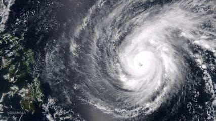
MANILA - Will Typhoon Chedeng (international name Maysak) bring storm surges to the Philippines?
According to PAGASA weather forecaster Rene Pasyente, Chedeng could generate storm surges as high as four to five meters but noted that this could still change because the typhoon is still too far.
He said the weather bureau will give a forecast on storm surge heights 48 hours before Chedeng makes landfall.
He also said the storm surges brought by Typhoon Yolanda (Haiyan) in 2013 were much higher.
"Yung four to five meters mga isang story, isa't kalahating story building yun, more or less. Mas malaki ang storm surge na dala ni Yolanda. May mga areas na umaabot ng 10 meters so yung 10 meters is about a 3-story building. Mas malaki hamak yung storm surge na dala ni Yolanda," he said in a press briefing Wednesday.
Chedeng is packing 195 kph winds and gusts of up to 230 kph. The typhoon is forecast to make landfall in the Aurora-Quezon-Isabela area late Saturday (April 4) or early Sunday (April 5).
The government's Project NOAH earlier developed a storm surge warning system similar to typhoon signals being issued by state weather bureau PAGASA.
Project NOAH listed four different warning signs that will alert coastal communities about an impending storm surge.
SS1 or storm surge signal number 1: A water level surge as high as 2 meters or about 6 feet. Swimming and surfing will not be allowed, fishermen are advised to take precautions, and residents are advise to strengthen their houses.
SS2 or storm surge signal number 2: A water level surge as high as 3 meters or about 9 feet. Fishing is not allowed, and residents are advise to prepare for evacuation.
SS3 or storm surge signal number 3: A water level surge as high as 4 meters or about 12 feet. Residents are advised to evacuate to higher ground.
SS4 or storm surge signal number 4: A water level surge of 5 meters or about 15 feet or higher. Residents are strongly advised to evacuate.
Abs-cbnnews.com


