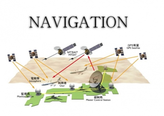
FLIGHT NAVIGATION
"It is a science of directing an aircraft from one place to another place safely and efficiently and knowing the position of aircraft at any instance."
FORM OF THE EARTH
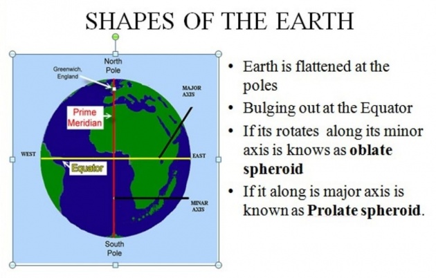
SHAPE OF THE EARTH
Earth is flattened at the poles and bulging out at the Equator due to difference in its polar and equatorial diameters are 7900 and 7927 miles respectively there fore earth ins not a perfect sphere but its is spheroid, but practical navigation earth is considered as a perfect sphere and 27 miles are ignored.
(the spheroid which rotates along its minor axis is knows as oblate spheroid and which rotates along is major axis is known as prolate spheroid.)
ROTATION OF THE EARTH
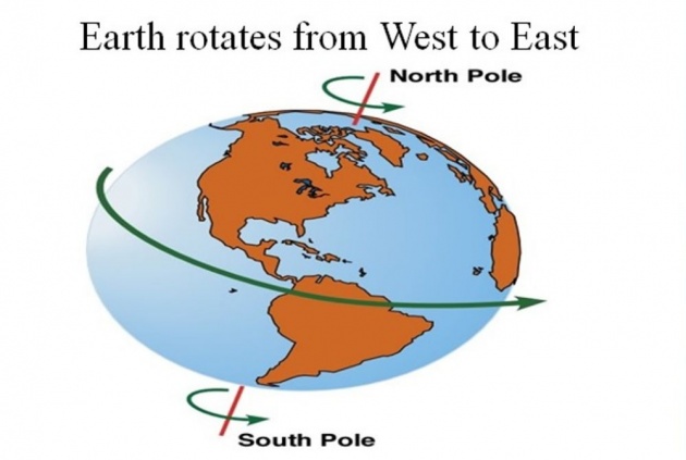
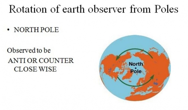
Earth rotates from West to East, if we look at the north pole then the rotation is observed to be anti or counter clock wise and when we look at the South Pole the rotation is observed to be clock wise .
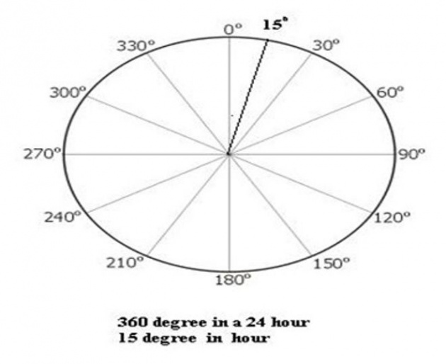
Earth rotates at the rate of 360 degrees in 24 hours or 15 degrees per hour.
Earth rotates at the rate of 360 degrees in 24 hours or 15 degrees per hour
LINES ON THE EARTH
- EQUATOR
- GREAT CIRCLE
- RHUMB LINE
- MERIDIANS
- PARALLELS
- POLES
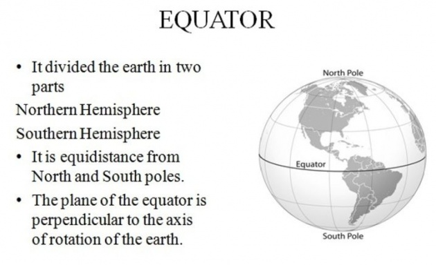
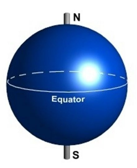
EQUATOR
Equator is the line drawn on the surface of the earth which divides the earth into two equal parts known as Northern Hemisphere and Southern Hemisphere, such a line also called a Great Circle. Every point on equator is equidistance from North pole and South poles and the plane of the Equator is perpendicular to the axis of rotation of the earth.
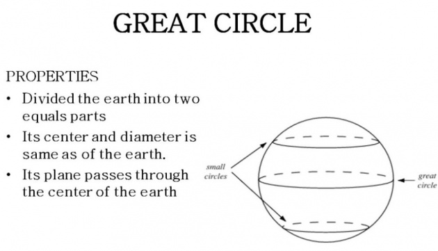
GREAT CIRCLE
Great circle is a circle on the surface of the earth which divides the earth into two equals parts, the shortest distance between any two points on the surface of the earth is the smaller arc of the great circle joining them.
GREAT CIRCLE
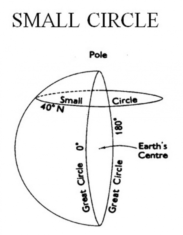
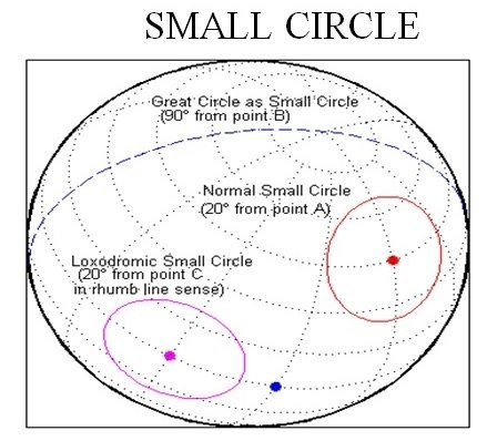
SMALL CIRCLE
"It is a circle drawn on the surface of the earth.
All circles drawn on the surface of the earth other than are small circle."
Properties
- Do not divide the earth into two equal parts.
- Do not have the same center and diameter as that of the earth.
- Its plane does not pass through the center of the earth.
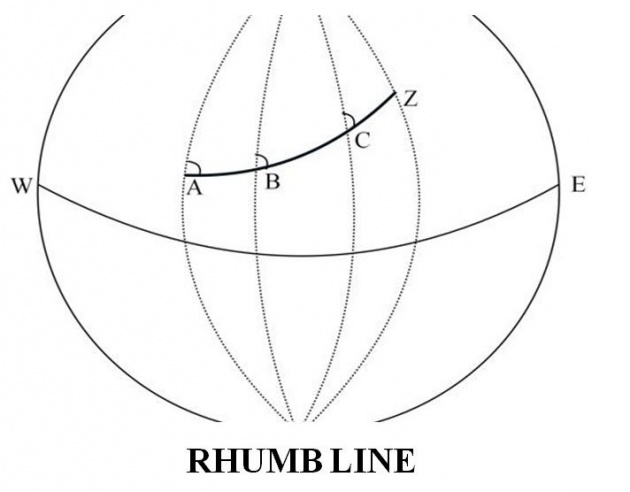
RHUMB LINE
A regular curved line drawn on the surface of the earth which maintains it direction and cut the meridians at same angle is known as
Note : Rhumb line never reaches the poles.
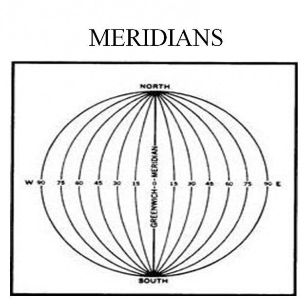
MERIDIANS
A semi great circle which joins North and south pole is known as Meridian.
Every meridians has its meridians whose directions opposite to the direction of the meridian,each meridians indicate North and South.
(Note :-meridians and its anti meridians from a great circle)
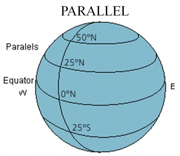
PARALLEL
A line drawn on the surface of the earth which is parallel to equator is known as PARALLEL.
Each parallel is a small circle and indicate East and West and its parallel to equater.
All parallels and meridians intersect at right angle and accourding to the defination of Rhumb Line each meridians is a rhumb line but not a great circle but on the other hand each parallel is a small circle but all small but all small circles are not parallel.
PARALLEL
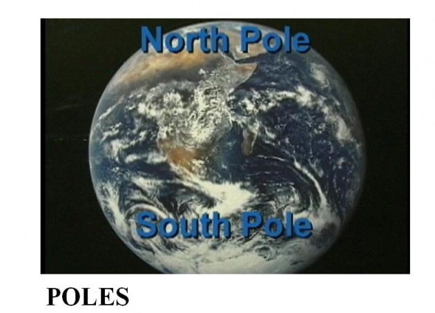
POLES
The extremes about which the earth rotates are known as POLES.
Direction of the earth
- TRUE DIRECTION
- MAGNETIC DIRECTION
- CAMPASS DIRECTION
True direction
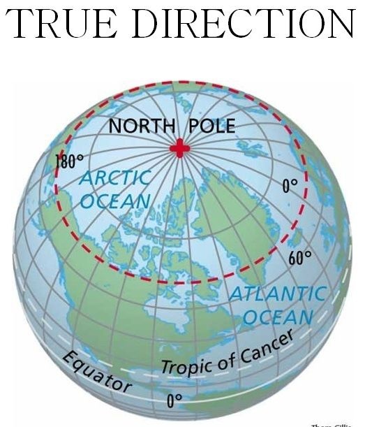
Direction along geographical north is known as True Direction.
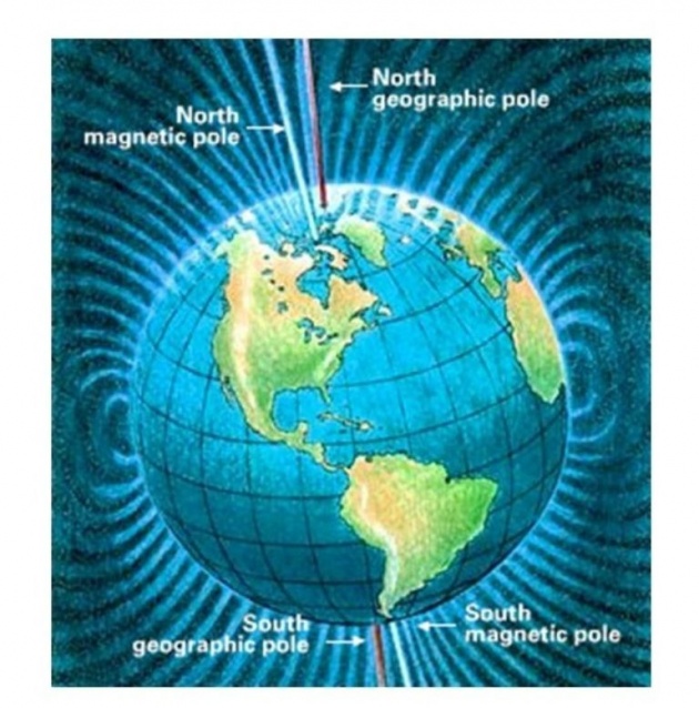
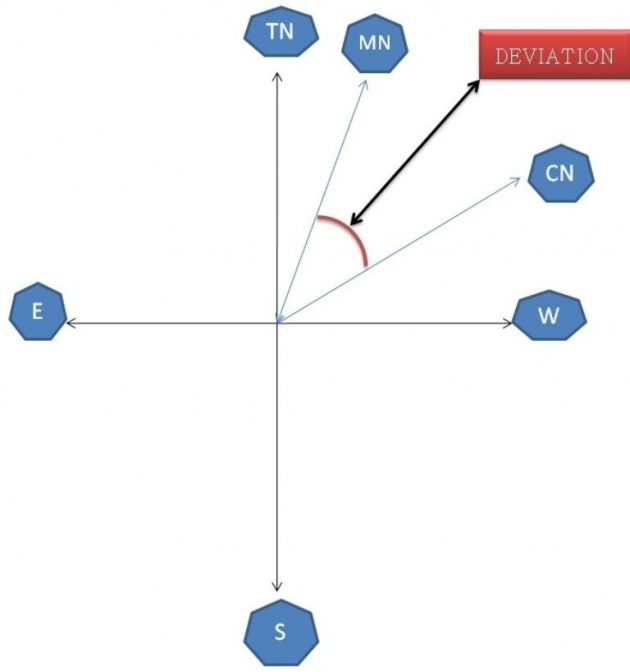
MAGNETIC DIRECTION
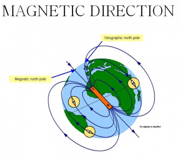
Direction with reference to magnetic north pole is known as magnetic direction.
COMPASS DIRECTION
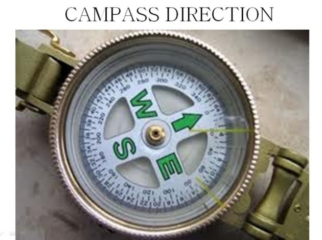
Direction indicating by the needle of compass in the cockpit of aircraft is known as Compass Direction. 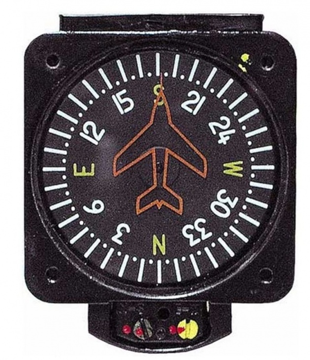
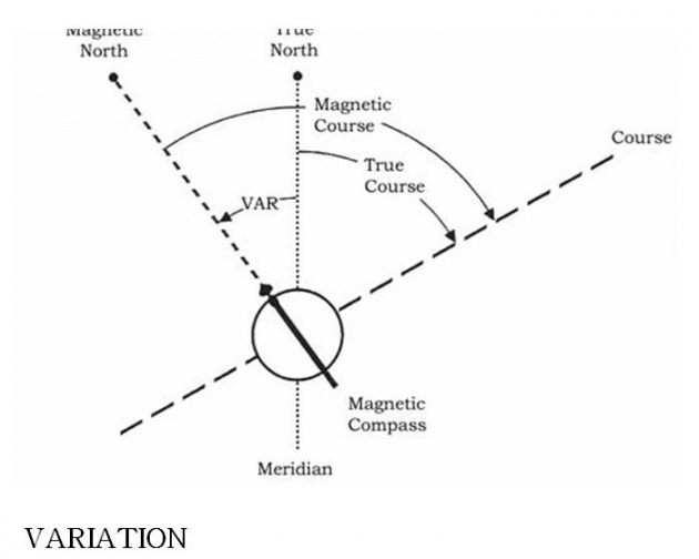
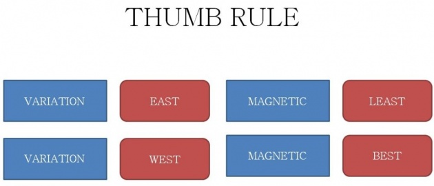
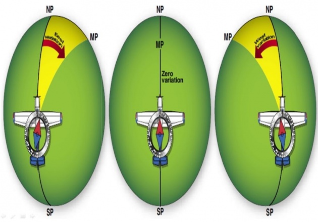
VARIATION
Variation is an angular difference between true and magnetic direction and it is further described as variation east and variation west .
CALCULATION
For calculation of magnetic direction variation east is always subtract from true direction and variation west is always added to true direction.
If variation is east magnetic direction will be less than true direction or magnetic direction will be least and if variation is west then magnetic direction will be greater than true direction or magnetic direction will be best.
In case if true and magnetic directions are same then it means that the variation is Zero.
THUMB RULE
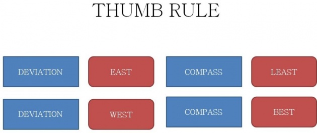
DEVIATION
Deviation is an angular difference between magnetic and compass direction and its further describes as deviation east and deviation west.
CALCULATION
For calculation of compass direction deviation east is always subtracted from magnetic and deviation west is always added to magnetic direction.
If deviation is east compass direction will be less then magnetic direction or compass direction will be least and if deviation is west then compass direction will be greater then magnetic direction or compass direction will be best.
THUMB RULE
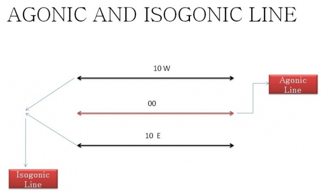
AGONIC LINE
An imaginary line around the earth passing through both the north pole and the north magnetic pole, at any point on which a compass needle points to true north.
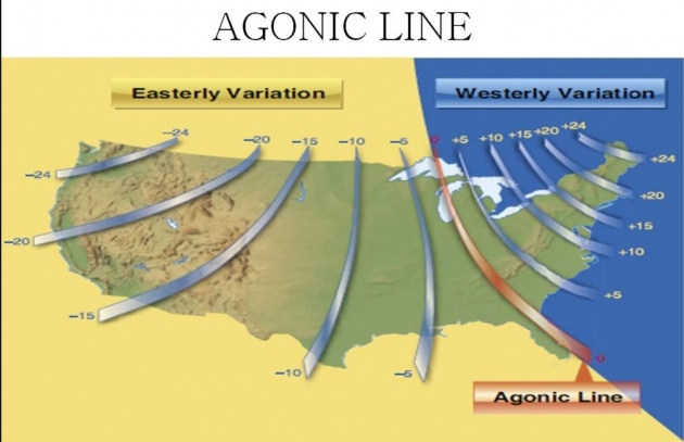
“LINE joining the points of ZERO variation is known as Agonic Line”
AGONIC LINE
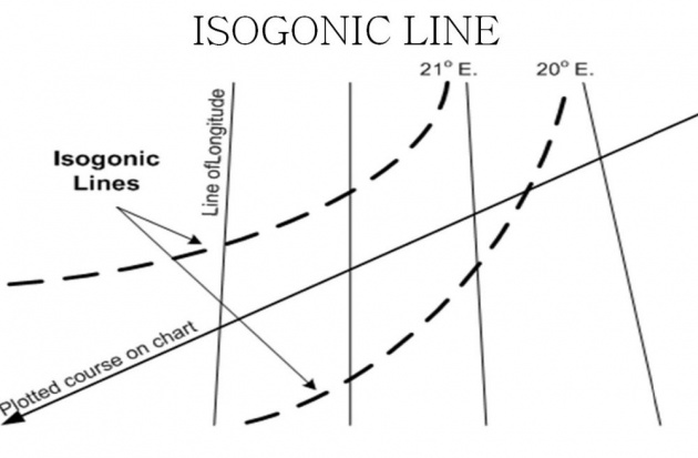
ISOGONIC LINE
An imaginary line connecting points on the Earth's surface where the magnetic declination is the same.
Line joining the points of equal variation is known as Isogonic Line.
AGONIC AND ISOGONIC LINE
DISTANCE
The space between two objects. The length of a line, especially the shortest line joining two points or things that are separate; measure of separation in place.
Following three main units of distance are used in aviation
- Nautical Mile
- Statute Mile
- Kilometer
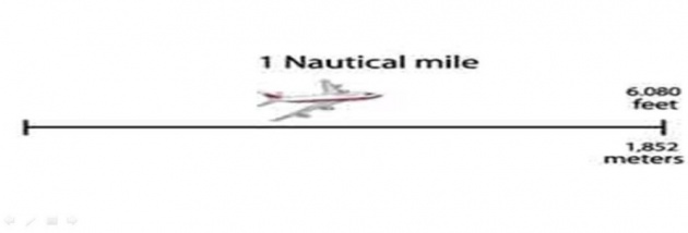
NAUTICAL MILE
“One minute arc of a great circle is equals to one nautical mile”
1 Nautical Mile = 6080 feet
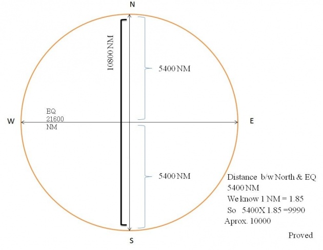
Therefore the length of the equator is equal to
360X60=21600NM, now calculate the distance between poles in NM
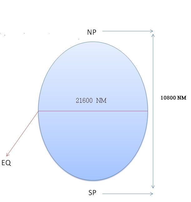
Length of EQ 360X60=21600
Poles =21600/2
10800 NM
STATUTE MILE
Statute means because of Law.
1 Statute Mile = 5280 feet
Kilometer
One Kilometer means 1000 meters.
1 Kilometer =3280 feet
Kilometers is 1/10,000th part of the total distance between equator and the north and south pole .
POSITION ON EARTH
1. PARALLEL OF LATITUDE
2. LONGITUDE
BEFORE WE KNOW THE TOPIC WE MUST KNOW ABOUT LATITUDE & LONGITUDE
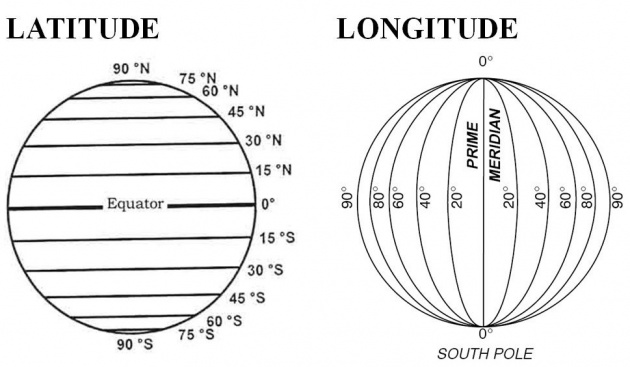
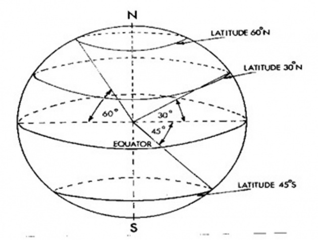
PARALLEL OF LATITUDE
An angle subtended at the center of the earth by an arc of a meridian intercepted between the equator and reference point.
OR
An angular distance measured between the equator and reference point(parallel).
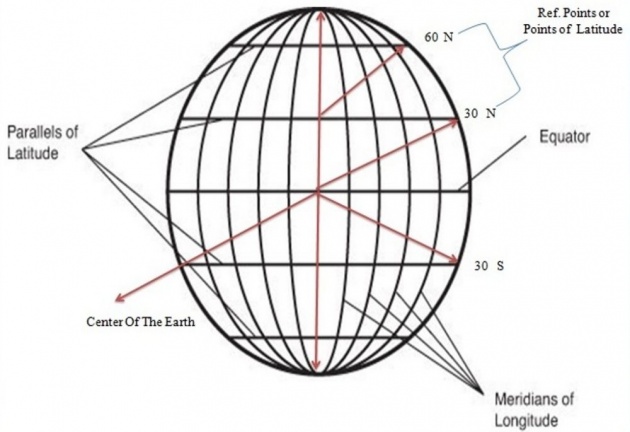
Parallel of latitude are measured from equator to 90 degree North and 90 degree South now if two adjacent parallels are 1 degree apart then 180 degree parallels can be drawn on both sides of equator, we can also say the parallels of latitude are small circles on the surface of the earth whose planes are parallel to the plane of the equator.
Longitude
An angle subtended at the center of the earth by the smaller arc of the equator between prime meridian and the meridian passing through the reference points.
OR
An angular distance measured between the prime meridian and meridian passing through the reference point.
(NOTE: Network of Latitude and Longitudes is known as Graticule.)
CHANGE OF LATITUDE
Change of latitude is a angular distance measured along a meridian intercepted between the two reference parallels.
Change of latitude is an arc of meridians intecepted between the two reference parallels..
CHANGE OF LATITUDE
Change of latitude is an angle substended at the center of the earth by an arc of a meridian intercepted between the two refrence parallels.
CHANGE OF LONGITUDE
it is the smaller angle measured at the north or south pole between the two refrences meridians .
(two meridians passing through the two refrence points named as East or West accourdig to the destination point from the deparature points).
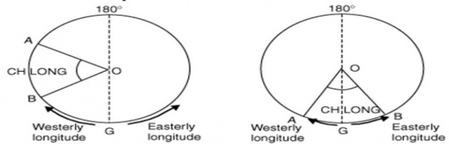
NOTE
If the points are in differents longitudes then their values are added and if it becomes greater than 180 degree then it is subtracted from 360 degree and the direction is then departure point direction.
(Thumb Rule)
DEPARTURE
DISTANCE BETWEEN two meridians along given latitude is known as Departure, as we know that the meridians parallel to each others at equator but their distance decrease with the increase alltitude.
There fore departure =ch long (60)XCOS Lat
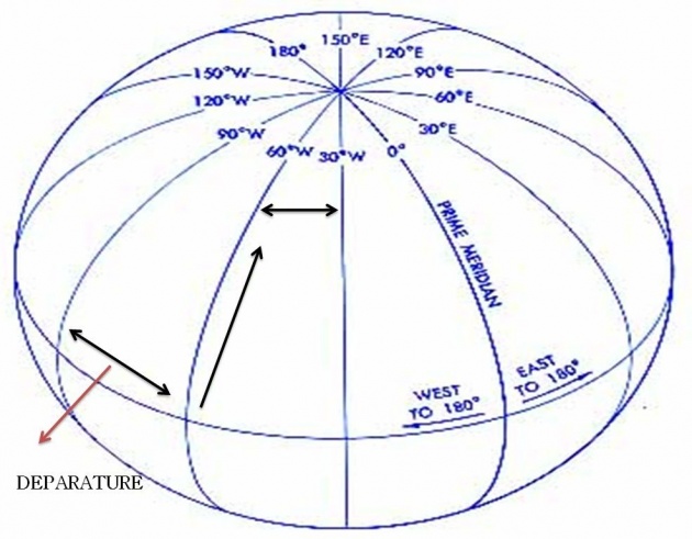
For Example
Distance between two meridians along given 1 degree apart at equator will be
1 X 60=60 NM
but at 60 N this distance will be
1 X 60 X COS =30 NM
and at the pole where latitude is 90 degree it will be 1 X COS X 90= 0.
NAVIGATION TERMINOLOGIES
WIND
Horizontal movement of air is know as wind.
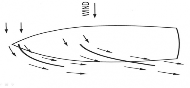
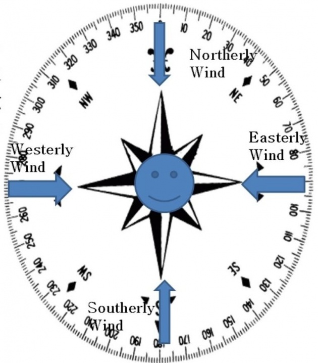
WIND DIRECTION
wind direction is the direction from which the wind is blowing towards the station(observer).
WIND SPEED
Distance travel by wind in one hour (speed of the wind relative to ground)
WIND VELOCITY
Wind velocity is the term which describes both wind direction and wind speed, it has five places in which first three places are for direction and last two places are for speed.
27010
270 wind direction(degree)
10 wind speed(knots)
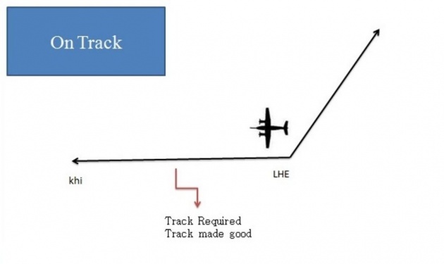
TRACK
Track is a path traveled by an aircraft over the ground to reach from one point to another point.
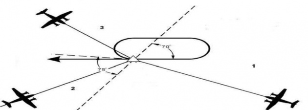
Track Required
The track which an aircraft is supposed to fly to reach from one place to another point is known as Track Required.
Track Made Good(TMG)
The track which an aircraft is actually flying is known as Track Made Good.
Note:
If track required and track made good are same its mean aircraft is On Track.
If there is a difference between track required and track made good then its mean aircraft is Off Track.
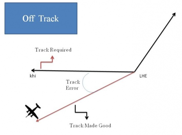
Track Error
Angle between track Required and track made good is known as Track Error

SPEED & WIND
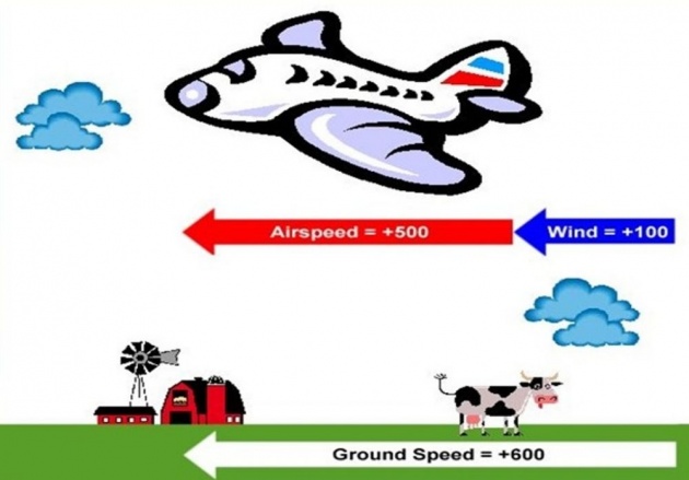
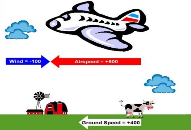
Ground Speed
Speed of the aircraft relative to the ground is called Ground Speed(GS).
Air Speed
Speed of the aircraft relative to the surrounding air is called ground Speed.
Calm Wind
When the speed of the wind is zero it is said to be Calm condition and this condition Airspeed and Ground Speed are equal.
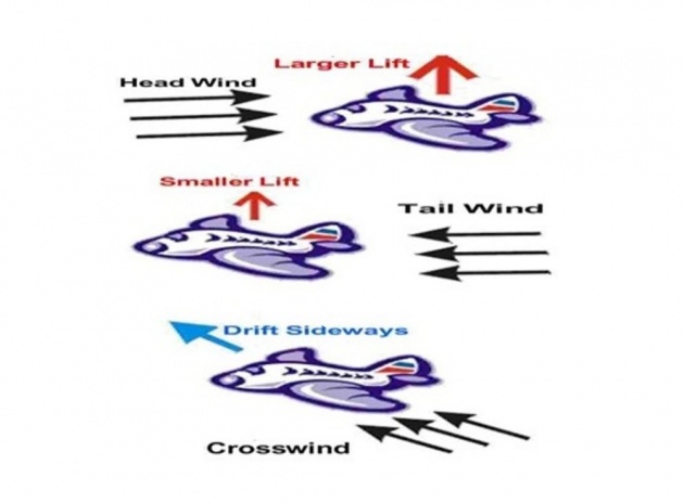
Tail Wind
If the speed is flowing in the direction in which an aircraft is flying then such a wind is known as Tail Wind in this condition Ground speed is greater than Airspeed.
Head Wind
If the speed is flowing in the opposite direction in which an aircraft is flying then such a wind is known as Head Wind in this condition Ground speed is Less than Air Speed.
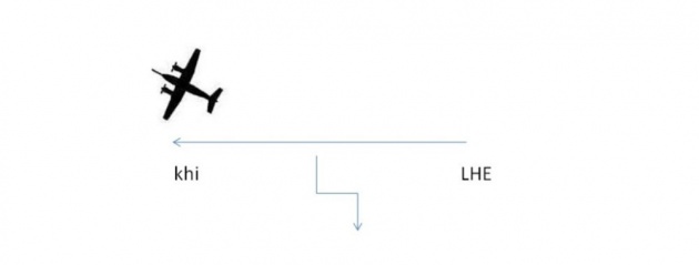
HEADING
The direction in which the nose of the aircraft is known as Heading.
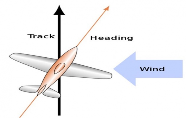
DRIFT
An angle between Track Made Good and Heading is known as Drift.
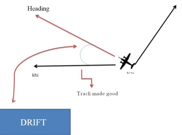
If the Drift is towards Right Then
Heading =Track –Drift
and
If the drift is towards Left then
Heading=Track+Drift
THANK YOU