TORNADO

Posted on at


Tornadoes  


What is a tornado?

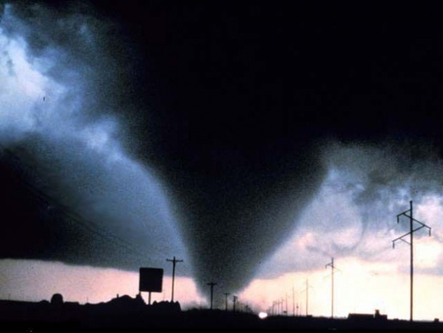
A tornado is a violent rotating column of air extending from a thunderstorm to the ground. The most violent tornadoes are capable of tremendous destruction with wind speeds of up to 300 mph. They can destroy large buildings, uproot trees and hurl vehicles hundreds of yards. They can also drive straw into trees. Damage paths can be in excess of one mile wide to 50 miles long. In an average year, 1000 tornadoes are reported nationwide.

How do tornadoes form?

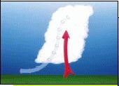
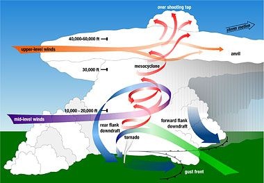
Most tornadoes form from thunderstorms. You need warm, moist air from the Gulf of Mexico and cool, dry air from Canada. When these two air masses meet, they create instability in the atmosphere. A change in wind direction and an increase in wind speed with increasing height creates an invisible, horizontal spinning effect in the lower atmosphere. Rising air within the updraft tilts the rotating air from horizontal to vertical. An area of rotation, 2-6 miles wide, now extends through much of the storm. Most strong and violent tornadoes form within this area of strong rotation. 

What are some other factors for tornadoes to form?

Several conditions are required for the development of tornadoes and the thunderstorm clouds with which most tornadoes are associated. Abundant low level moisture is necessary to contribute to the development of a thunderstorm, and a "trigger" (perhaps a cold front or other low level zone of converging winds) is needed to lift the moist air aloft. Once the air begins to rise and becomes saturated, it will continue rising to great heights to produce a thunderstorm cloud, if the atmosphere is unstable. An unstable atmosphere is one where the temperature decreases rapidly with height. Atmospheric instability can also occur when dry air overlays moist air near the earth's surface. Finally, tornadoes usually form in areas where winds at all levels of the atmosphere are not only strong, but also turn with height in a clockwise or veering direction.

What do tornadoes look like?

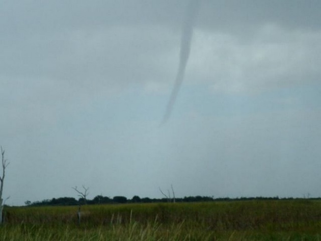
Tornadoes can appear as a traditional funnel shape, or in a slender rope-like form. Some have a churning, smoky look to them, and other contain "multiple vortices", which are small, individual tornadoes rotating around a common center. Even others may be nearly invisible, with only swirling dust or debris at ground levels as the only indication of the tornado's presence.

What is a funnel cloud? 

A funnel cloud is a rotating cone-shaped column of air extending downward from the base of a thunderstorm, but not touching the ground. When it reaches the ground it is called a tornado.    

How do tornadoes stop?

It is not fully understood about how exactly tornadoes form, grow and die. Tornado researchers are still trying to solve the tornado puzzle, but for every piece that seems to fit they often uncover new pieces that need to be studied.  

What is a supercell thunderstorm?

A supercell thunderstorm is a long-lived thunderstorm whose updrafts and downdrafts are in near balance. These storms have the greatest tendency to produce tornadoes that stay on the ground for long periods of time. Supercell thunderstorms can produce violent tornadoes with winds exceeding 200 mph.

What is a mesocyclone? 

A mesocyclone is a rotating vortex of air within a supercell thunderstorm. Mesocyclones do not always produce tornadoes.

 What is a microburst? 

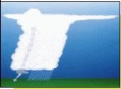
A microburst is a downdraft (sinking air) in a thunderstorm that is less than 2.5 miles in scale. Although microbursts are not as widely recognized as tornadoes, they can cause comparable, and in some cases, worse damage than some tornadoes produce. In fact, wind speeds as high as 150 mph are possible in extreme microburst cases. 

What is a wall cloud?

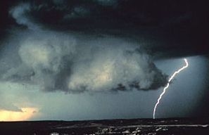
A wall cloud is an abrupt lowering of a rain-free cumulonimbus base into a low-hanging accessory cloud. A wall cloud is usually situated in the southwest portion of the storm. A rotating wall cloud usually develops before tornadoes or funnel clouds.

What is a waterspout?

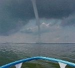
A waterspout is just a weak tornado that forms over water. They are most common along the Gulf Coast. Waterspouts can sometimes move inland, becoming tornadoes causing damage and injuries. 

What is hail?

Hail is created when small water droplets are caught in the updraft of a thunderstorm. These water droplets are lifted higher and higher into the sky until they freeze into ice. Once they become heavy, they will start to fall. If the smaller hailstones get caught in the updraft again, they will get more water on them and get lifted higher in the sky and get bigger. Once they get lifted again, they freeze and fall. This happens over and over again until the hailstone is too heavy and then falls to the ground. 

What is the largest hailstone recorded in the United States?

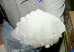
According to the National Weather Service, the largest hailstone is 8 inches in diameter and weights approximately 2 pounds. It fell in Vivian, South Dakota on July 23, 2010.

What is a gustnado?

A gustnado is a short-lived, relatively weak whirlwind that forms along a gust front. A gust front is the surge of very gusty winds at the leading edge of a thunderstorm's outflow of air. Gustnadoes are not tornadoes. They do not connect with any cloud-base rotation. But because gustnadoes often have a spinning dust cloud at ground level, they are sometimes wrongly reported as tornadoes. Gustnadoes can do minor damage. 

What is a landspout?

A landspout is a very weak tornado that is not associated with a wall cloud or a mesocyclone. It is the land equivalent of a waterspout.

What is a dust devil?

A dust devil generally forms in the hot sun during the late morning or early afternoon hours. These are mostly harmless whirlwinds and are triggered by light desert breezes that create a swirling plume of dust with speeds rarely over 70 mph. These differ from tornadoes in that they are not associated with a thunderstorm (or any cloud) and are usually very weak.

When are tornadoes most likely to occur?

Tornadoes can happen at any time of the year and at any time of the day. In the southern states, peak tornado season is from March through May. Peak times for tornadoes in the northern states are during the summer. A few southern states have a second peak time for tornado outbreaks in the fall. Tornadoes are most likely to occur between 3 p.m. and 9 p.m.

Where are tornadoes most likely to occur?
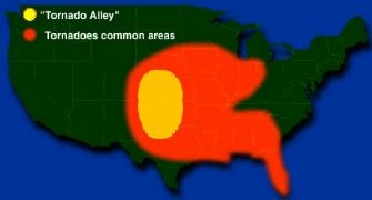
The geography of the central part of the United States, known as the Great Plains, is suited to bring all of the ingredients together to forms tornadoes. More than 500 tornadoes typically occur in this area every year and is why it is commonly known as "Tornado Alley". Texas, Oklahoma, Kansas, Nebraska, South Dakota, North Dakota, Iowa, Missouri, Arkansas and Louisiana all make up Tornado Alley

Know the Facts Tornadoes can occur at any time of the year.

No terrain is safe from tornadoes.

Never open windows in severe weather situations. This allows damaging wind and debris to enter the structure.

69% of all tornadoes are labeled "weak tornadoes" meaning they have a lifetime of 1-10+ minutes and winds less than 110 mph.

29% of all tornadoes are labeled "strong tornadoes" meaning they last 20 minutes or longer and winds reach 110-205 mph.

2% of all tornadoes are labeled "violent tornadoes" and can last over an hour.

Tornado Safety Tips

BEFORE A TORNADO:Have a disaster plan. Make sure everyone knows where to go in case a tornado threatens. Make sure you know which county or parish you live in. Prepare a kit with emergency food for your home. Have enough food and water for at least 3 days.

DURING A TORNADO:

Go to a basement. If you do not have a basement, go to an interior room without windows on the lowest floor such as a bathroom or closet. If you can, get under a sturdy piece of furniture, like a table. If you live in a mobile home get out. They offer little protection against tornadoes. Get out of automobiles. Do not try to outrun a tornado in your car, leave it immediately. If you’re outside, go to a ditch or low lying area and lie flat in it. Stay away from fallen power lines and stay out of damaged areas.

IF YOU’RE AT SCHOOL DURING A TORNADO:

Every school should have a disaster plan and have frequent drills. Basements offer the best protection. Schools without basements should use interior rooms and hallways on the lowest floor away from windows. Crouch down on your knees and protect your head with your arms.

AFTER A TORNADO:

Stay indoors until it is safe to come out. Check for injured or trapped people, without putting yourself in danger. Watch out for downed power lines. Use a flashlight to inspect your home.


160